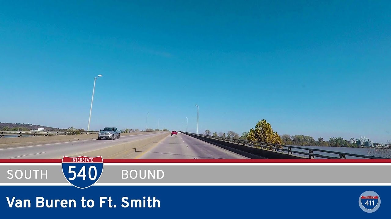
Take a scenic ride through the Arkansas River Valley as we follow Interstate 540 from the Oklahoma state line near Fort Smith to its northern terminus in Van Buren. This 15-mile drive offers a smooth glide through a blend of industrial heritage, suburban neighborhoods, and natural beauty—all framed by the distant hills of the Ozarks and the powerful flow of the Arkansas River.
Our journey begins just over the state line on U.S. Highway 271 in Oklahoma. As we cross into Arkansas, the designation shifts and the highway becomes Interstate 540, curving northeastward into Fort Smith. Almost immediately, we encounter the interchange with US-71, a longstanding north-south route that once served as the region’s main highway before the interstates arrived. Within moments, Arkansas Highway 45 branches off toward the heart of Fort Smith, while we continue along the east side of town. The corridor here is framed by a patchwork of commercial development and wooded buffers—an area that’s grown steadily in recent decades as Fort Smith expanded eastward.
Further along, we pass near the Fort Smith Regional Airport, its control tower and airfield visible just west of the highway. This stretch of I-540 reflects the area’s dual character—part transportation hub, part quiet river city. As we approach the AR-22 interchange, we cross into the more residential and greenbelt-heavy edge of town. Fort Smith itself, founded in 1817 as a military outpost on the frontier, has grown into a regional center with a strong industrial legacy, from railroads to manufacturing. The city’s layout reflects this evolution, with highways like I-540 acting as the connective tissue between neighborhoods and surrounding towns.
North of AR-22, the road bends gently northeast and prepares for its signature moment: the Arkansas River crossing. The bridge here offers panoramic views of the river below and the wooded floodplain that stretches along its banks. As we cross, we leave Fort Smith behind and enter Van Buren, the historic county seat of Crawford County. Immediately on the other side of the river, we reach the US-64 interchange, a route that predates the interstate system and once carried travelers across the state. US-64 leads directly into Van Buren’s charming downtown—home to preserved 19th-century architecture and a growing number of antique shops, cafés, and civic landmarks, many of which are supported by Main Street Van Buren, a local revitalization organization.
The drive concludes as we approach the towering interchange with Interstate 40, where I-540 finds its northern terminus. Here, travelers can turn east toward Little Rock or Memphis, or west toward Oklahoma City and beyond. Just beyond the highway to the east, outdoor enthusiasts can tap into the scenic Arkansas River Trail, which links parks, historic sites, and riverfront paths along one of the state’s most iconic waterways. Though short in length, this stretch of I-540 serves as a vital connector in western Arkansas, linking two historic river towns and acting as a gateway to the broader interstate network.
Reflecting on this drive, we’re reminded that even modest stretches of interstate can reveal a great deal about the character of a region. I-540 is more than a bypass or feeder—it’s a snapshot of how Arkansas balances tradition and progress, nature and infrastructure. Whether you’re just passing through or headed into town, this route provides a fast, scenic, and context-rich introduction to the Fort Smith–Van Buren corridor.
🗺️ Route Map
0 Comments