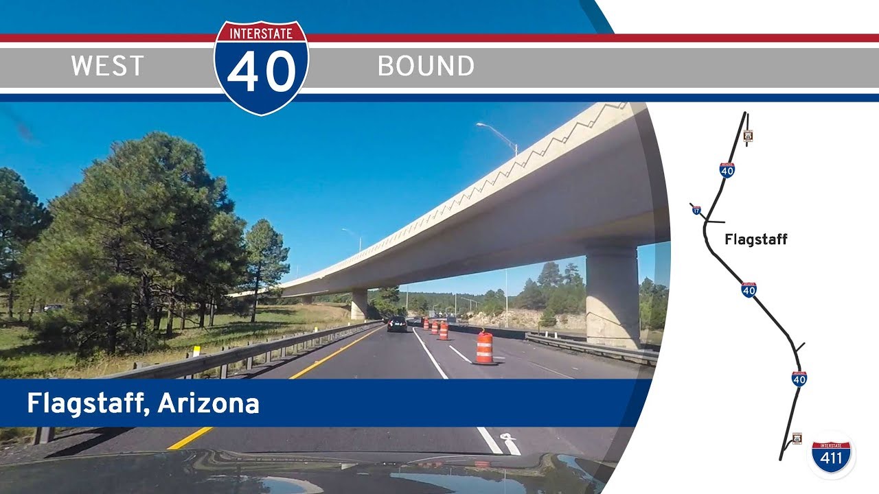
Take a high-country journey through the heart of northern Arizona as we follow Interstate 40 from the mountain town of Flagstaff to the gateway of the Grand Canyon—Williams. This 26-mile stretch of highway traverses sweeping pine forests, volcanic plateaus, and remnants of old Route 66, blending natural beauty with the lore of America’s great western roadways.
We begin our drive on the west side of Flagstaff, merging onto Interstate 40 from Interstate 40 Business—also known here as Historic Route 66. Surrounded by ponderosa pine and flanked by the San Francisco Peaks in the distance, we’re quickly reminded that Flagstaff sits at an elevation of nearly 7,000 feet, making it one of the highest cities on the entire Interstate system. As we head west, the landscape subtly begins to drop away, and we start a descent across a series of gentle ridgelines. The initial grades are relatively steep, providing panoramic views of the surrounding Coconino National Forest and wide-open meadows that break through the tree line. This transition zone between alpine forest and high desert sets the tone for much of northern Arizona’s scenic charm.
Just a few miles out of town, we approach the small community of Bellemont, which lays claim to being the highest settlement along the entirety of Route 66. Bellemont is more than just a dot on the map—it’s home to the Route 66 Roadhouse Bar & Grill and a restored stretch of the original Mother Road, as well as an active BNSF rail yard that reminds us of the corridor’s dual importance as both a freight and travel route. Modern travelers may miss it at highway speed, but those who exit here can find echoes of the 20th-century boomtown era still visible in the local businesses and scattered lodging.
West of Bellemont, the forest continues but begins to thin ever so slightly. We pass the unincorporated area of Parks, a rural enclave nestled between the forest and I-40, where log cabins and ranch-style homes are tucked beneath the pines. This portion of the drive is marked by wide sweeping curves and long straightaways, allowing us to relax into the rhythm of the road. Wildlife crossings are common in this region, with signs regularly reminding drivers to keep an eye out for elk and deer—especially near dawn and dusk. The changing light through the trees creates a near-constant dance of shadows, giving the drive a dynamic, almost cinematic feel.
Before long, we approach the outskirts of Williams, a town that proudly advertises itself as “the Gateway to the Grand Canyon.” At the interchange with Arizona Highway 64—the primary access route to the South Rim—we’re reminded just how closely I-40 tracks with adventure. Williams is one of the best-preserved Route 66 towns in the country, complete with neon signs, vintage motels, and the iconic Grand Canyon Railway, which still runs daily excursions north into the canyon. Although the interstate technically bypasses the historic downtown district, it parallels the former alignment of Route 66, which remains a draw for tourists and nostalgic travelers alike.
We conclude our drive on the western edge of Williams, just past the final interchange with Historic Route 66. Here, the pine trees grow dense again, and the terrain begins to flatten out in preparation for the long descent toward Ash Fork and the lower elevations beyond. It’s a fitting end to a short but memorable segment of highway that stitches together two iconic towns and offers a perfect balance of elevation, evergreen, and nostalgia.
🗺️ Route Map

0 Comments