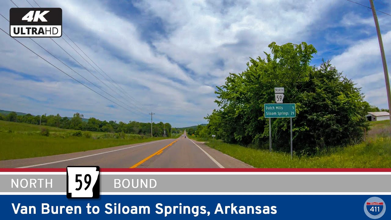
Take a scenic ride through the western edge of the Arkansas Ozarks as we follow a peaceful stretch of Arkansas Highway 59 from Van Buren to Siloam Springs. This 58-mile journey winds through hidden hamlets, pastoral valleys, and forested ridgelines—offering a quieter, slower-paced alternative to the bustle of nearby interstates. Along the way, we’ll pass through communities steeped in pioneer history, skirt tranquil creeks, and uncover the rustic beauty of the Mountain Fork Valley.
Our drive begins at the northern edge of Van Buren, where Highway 59 departs from Interstate 40. Van Buren, a historic town nestled along the Arkansas River, is known for its 19th-century Main Street and as a gateway to the Fort Smith metro area. But just a few minutes north of town, the suburban backdrop gives way to wide-open fields and distant tree-covered ridges. We quickly find ourselves entering the more serene contours of Crawford County, following the Mountain Fork Valley rather than ascending into the rougher Boston Mountains to the east. The road here is easygoing and surrounded by gentle farmland and the kind of quiet homesteads that mark generations of rural Arkansas life.
Just up the road lies Cedarville, a small crossroads community where local churches and a few small businesses anchor daily life. From here, Highway 59 begins to flirt with the edges of the Ozark National Forest’s influence—rolling hills rise and fall with increasing rhythm, and the landscape becomes more wooded. We soon reach Natural Dam, named for the unique rock formation that spans Lee Creek, creating a natural waterfall across its width. It’s a postcard-worthy spot that’s drawn travelers for generations and offers a chance to stretch your legs and snap a photo of one of Arkansas’s subtle scenic gems.
North of Natural Dam, the route continues to wind through the Mountain Fork Valley, a less-traveled but deeply beautiful region. The road rises and dips as it crosses the creek again and again, threading its way between old pastures and hills draped in oak and hickory. We pass Evansville, a quiet place nestled just south of the Washington County line, where the ghost of a once-active trading center still lingers in the remaining structures and small farms. Then it’s on through Tolu and Dutch Mills—more specks on the map than destinations, but each with its own quiet rhythm and deep-rooted place in the local fabric.
As we cross into Washington County, the terrain becomes a touch more open, with pastures yielding to long views across low ridges. The town of Summers marks a major crossroads—here, U.S. Route 62 joins us for a brief overlap, offering a connection west to the Oklahoma border or east toward Fayetteville. Summers is small but busy by comparison, with a handful of stores and services clustered at the junction. Continuing northward, we soon reach Cincinnati—not to be confused with its Ohio namesake—a rural community that feels like the kind of place where time slows down and the seasons still define the calendar.
In the final stretch of our drive, the countryside begins to change once more. The hills soften, the farmland grows more expansive, and subtle signs of urban sprawl begin to appear. We enter Benton County and draw closer to Siloam Springs, where the once-quiet road becomes lined with housing subdivisions and small industry. Siloam Springs itself is a growing town with a charming downtown district, well-kept parks, and the namesake springs that first drew settlers to the area. Our journey ends at the junction with U.S. Route 412, a major east-west corridor linking Springdale to Tulsa.
From river town to ridge-top, from hidden waterfalls to windswept farmland, Arkansas Highway 59 offers a backroads portrait of western Arkansas. It’s a route where the scenery invites you to slow down, the towns tell their own quiet stories, and the hills remind you that beauty often lies in the roads less traveled.
🎵 Music: Track List
🗺️ Route Map
0 Comments