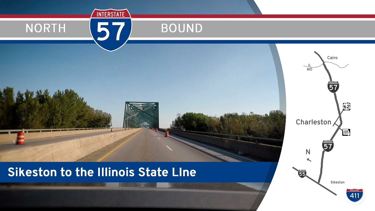
Take a scenic ride through the lush bottomlands and rolling farmland of southern Illinois as we follow Interstate 57 from the Mississippi River at the Missouri border to the bustling town of Marion. This 72-mile journey carries us through a blend of river country, small-town Americana, and the outer reaches of the Shawnee Hills, offering a snapshot of both historical and modern Illinois.
Our journey begins as we cross the towering Mississippi River bridge from Missouri, leaving behind the Bootheel region and entering Alexander County, Illinois. Right from the start, we’re immersed in a landscape shaped by rivers—broad floodplains stretch out on either side of the highway, remnants of a time when steamboats ruled these waters. Quickly, we reach the first major interchange with Illinois Route 3, a scenic highway that parallels the Mississippi and serves the nearby town of Cairo. Once a thriving port city, Cairo now stands as a sobering monument to shifting river routes and economic change, with its grand historic buildings and quiet streets. Continuing north, we breeze past Mounds and Mound City, the latter known for the Mound City National Cemetery, a somber but beautiful Civil War site nestled along the Ohio River’s backwaters.
As we push farther north, the highway gently arcs eastward, rising slightly from the lowlands into the more rolling terrain of Union County. Here, we approach the junction with U.S. Highway 51, one of the oldest north-south corridors in Illinois. Just west of us lies the Shawnee National Forest and the charming town of Anna, while Dongola to the east remains a quintessential Southern Illinois village. The landscape transitions from floodplain flatness to undulating fields and patches of woodland, offering glimpses of both cornfields and the dense oak-hickory forests that hint at the nearby Shawnee Hills. We soon encounter the IL-146 interchange near Anna-Jonesboro, a convenient route for exploring Giant City State Park, renowned for its towering sandstone bluffs and miles of hiking trails—a detour that tempts any nature lover passing through.
The ride grows busier as we continue north, brushing the edge of the Crab Orchard National Wildlife Refuge, where shimmering lakes and protected wetlands break up the expanse of farmland. Shortly after Lick Creek, we meet the northern terminus of Interstate 24, a major connection toward Paducah, Kentucky, and Nashville, Tennessee, carrying with it a surge of through traffic. Our path remains straight and steady as we close in on Williamson County, where rolling hills level out once again into a broad patchwork of suburban development and commercial centers. The final stretch leads us into Marion, where we exit at IL-13, the main arterial route slicing through the heart of the region. Marion has grown from its coal mining roots into a regional hub, with shopping, dining, and access to both Southern Illinois University in nearby Carbondale and the recreational opportunities of Lake of Egypt.
This stretch of Interstate 57 offers more than just a corridor from point A to point B—it’s a cross-section of Southern Illinois history, culture, and natural beauty. From the echoes of Civil War history to the evolving rhythms of rural towns and the draw of protected wilderness, this drive reminds us that even along the mainline of America’s interstate system, the spirit of place thrives in every mile.
🎵 Additional Music:
Training in the Fire by Twin Musicom is licensed under a Creative Commons Attribution license (https://creativecommons.org/licenses/by/4.0/)
Artist: http://www.twinmusicom.org/
🗺️ Route Map
0 Comments